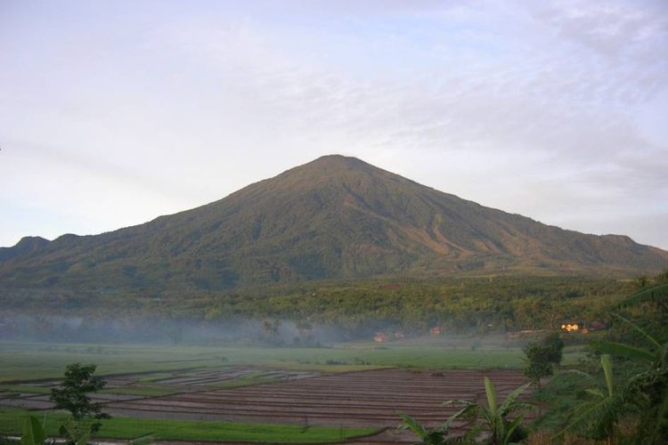
Mount Ciremai
Overview
 Region
Majalengka, West Java
Latitude6.895°S
Longitude108.408°E
Summit3039 m
Elevation9970 ft
Primary Volcano TypeComposite (Stratovolcano)
Last Known Eruption1951 CE
Literature and Analysis
Eruptive History Geomorphology Geological Settings Structure Reference Eruptive History1951 Mar 1 – 1951 Mar 2
| Date | Event Type | Fatalities | VEI | Event Remarks | Reference |
| 1951 Mar 1-2 | Explosion, Volcanic Smoke | 2 | [1] |
1937 Jun 24 – 1938 Jan 7
| Date | Event Type | Fatalities | VEI | Event Remarks | Reference |
| 1937 Jun – 1938 Jan | Explosion, Ash, Phreactic Activity | 2 | Ash fall occurred 10 km from the vulcano. Phreatic eruption occurred in the crater and the summits northern outer wall. Heavy rains produced mudflow (Oct) | [1][2] |
1805 Apr
| Date | Event Type | Fatalities | VEI | Event Remarks | Reference |
| 1805 Apr | Explosion, Ash, Phreactic Activity | 2 | [1] |
1775 Jan 4
| Date | Event Type | Fatalities | VEI | Event Remarks | Reference |
| 1775 Jan 4 | Explosion | 2 | [1] |
1772 Aug 11 – 1772 Aug 12
| Date | Event Type | Fatalities | VEI | Event Remarks | Reference |
| 1772 Aug 11- 12 | Explosion | 2 | [1] |
1698 Feb 3
| Date | Event Type | Fatalities | VEI | Event Remarks | Reference |
| 1698 Feb 3 | Explosion, Lahar or Mudflow | Exact number of victim not known | 3 | [1] |
[1] volcano.si.edu
[2] volcanolive.com